Application Development: DesktopGIS
We extend applications that do manage or process spatial data sofar without a GIS component with adequate visualization or geo-operations. We also are experienced in developing such applications from ground up. Depending on the actual needs, we select the Free Software components to be used. Apart from functionality, often the programming language is an important selection criterion.
Sample References
OpenJUMP - WFSPlugin
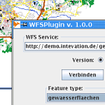
The Information Centre of the Ministry of Agriculture and Forestry, (TIKE), Finnland, sponsored the development of a WFSPlugin for the free java-based Desktop-GIS OpenJUMP.
The functionality was developed in cooperation with our partner lat/lon who did the main implementation coordinated by Intevation.
This plugin offers the possibility to add OGC Web Feature Services
(WFS) into OpenJUMP. The WFS-layers can be used as any other layer
within OpenJump. Currently WFS 1.0 and 1.1 are supported. More ...
OpenJUMP - PrintLayoutPlugin
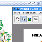
For the free java-based Desktop-GIS OpenJUMP Intevation developed a new Print- and LayoutPlugin.
It was sponsored by the Institute for environmental planning of the Leipniz-Universität Hannover.
The plugin provides features for creating print-templates in different formats (SVG, PNG, PDF, etc).
The PrintLayoutPlugin was released under the GNU Lesser General Public Licence (GNU/LGPL)
More ...
FLYS 2 - River Hydrology Software
The german federal authority Bundesanstalt für Gewässerkunde (BfG) developed FLYS (Flusshydrologischen Software, River Hydrology Software) between 1998 and 2006. FLYS can compute hydraulic water levels for the hydrologic information service of BfG. New is comprehensive access to the geographic data that were used for the one-dimensional mathematic flow models simulations and to other hydrologic data. This, in conjunction with further analysis methods, make FLYS 2.0 a powerful information tool for in-depth analysis of water levels of federal shipable surface waters such as Rhein, Main, Mosel, Weser und Elbe. More ...
GREAT-ER II - Geography-referenced Regional Exposure Assessment Tool for European Rivers
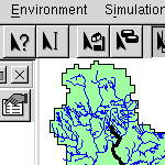
GREAT-ER is a simulation system for modeling the environmental fate of substances in rivers with a GIS based user interface. The development of GREAT-ER II is performed under the CEFIC Long Range Research Initiative (LRI) Environmental Exposure Programme. The tender has been awarded to the consortium of Intevation GmbH and TechniData AG, Markdorf (Germany) in late 2001. More ...
Decision Support System Elbe-DSS
The German Federal Institute of Hydrology (BfG) funded the development of a Decision Support System (DSS) for the Elbe river system. The aim of the project is to couple simulation models that were developed for the Elbe river system to a DSS that supports the user on decisions concerning the management of the elbe catchment. The great flooding in summer 2002 demonstrated the importance of this subject. More ...
 Sitemap
 Deutsch