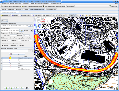
Sample Reference: FLYS 2 - River Hydrology Software


The german federal authority Bundesanstalt für Gewässerkunde (BfG) developed FLYS (Flusshydrologischen Software, River Hydrology Software) between 1998 and 2006. FLYS can compute hydraulic water levels for the hydrologic information service of BfG. New is comprehensive access to the geographic data that were used for the one-dimensional mathematic flow models simulations and to other hydrologic data. This, in conjunction with further analysis methods, make FLYS 2.0 a powerful information tool for in-depth analysis of water levels of federal shipable surface waters such as Rhein, Main, Mosel, Weser und Elbe.

The implementation of the GIS module for map views, extended analysis methods and a simulation system ware water surface levels (WSPLGEN) have been executed Sept. 2005 to Dec. 2006 by Intevation GmbH and STADT-LAND-FLUSS INGENIEURDIENSTE GmbH.
The Desktop-GIS module was based on the deegree framework and additional Free Software Java components, e.g. JFreeChart. WSPLGEN is realized as an independent program and published under GNU GPL.
 Sitemap
 Deutsch