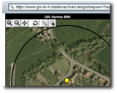
Sample Reference: Geodata server of district government Hannover
The district government (Bezirksregierung) of Hannover, Basson-Saxony, offered a geodata-server which gives the possibility to visualize geodata of the GIS-office in a web-browser. The applications on the server have been developed by the GIS office of the district government in cooperation with Intevation. As of January 1st 2005 the district governments of lower saxonia have been closed. The geodata-server remains in service.

In the beginning simple webmapping application based on the UMN Mapserver were developed. After a short time more complex applications were asked for. Thus an adress serach based on ALK/ALB-data and an application for point digitization have been realized.
To ensure a safe access of single users on specific applications and data Intevation developed a user management based on the web application framework Zope.
It has been very important during all the projects to pass on know-how to the district government. So the persons in charge are able to realize similiar application by themself. Therefore an administration documentation as well as an extensive written documentation of the internal functionality have always been part of the project.
 Sitemap
 Deutsch